
The Chalbi Desert is one of those places that rewards travelers who arrive knowing exactly what they are getting into. It is not a reserve with marked game-drive circuits and a lodge at the end of a smooth murram road. It is a vast, semi-arid salt pan sitting at around 350 meters above sea level in northern Kenya’s Marsabit County, roughly 400 kilometers from Nairobi by road. Conditions shift with weather and season. The surface that is firm and passable in September can become an impassable lake of standing water after significant rain. Planning here starts with operational honesty, not optimism.
What the Chalbi does offer, when approached properly, is a landscape experience with almost no parallel on the East African continent: open white flats stretching to volcanic horizons, communities who have lived at the edge of these conditions for generations, and a quality of silence that travelers who have only done circuit-safari Kenya will find genuinely startling.
What the Chalbi Desert Actually Is
The Chalbi covers approximately 100,000 hectares of flat, low-lying terrain formed in an ancient lake basin. The surface is composed of halite and clay minerals, giving it the characteristic white and grey tones visible from the air. Seasonal rainfall, when it comes, can temporarily flood large sections, transforming the pan into a shallow lake that attracts flamingos and waterfowl in brief, spectacular concentrations.
The desert sits between Marsabit to the south and Moyale to the north, with the Huri Hills rising to the east and the lower terrain toward Lake Turkana to the west. The town of North Horr, a Gabbra community settlement, sits roughly at the center of the Chalbi zone and serves as a practical orientation point for route planning.
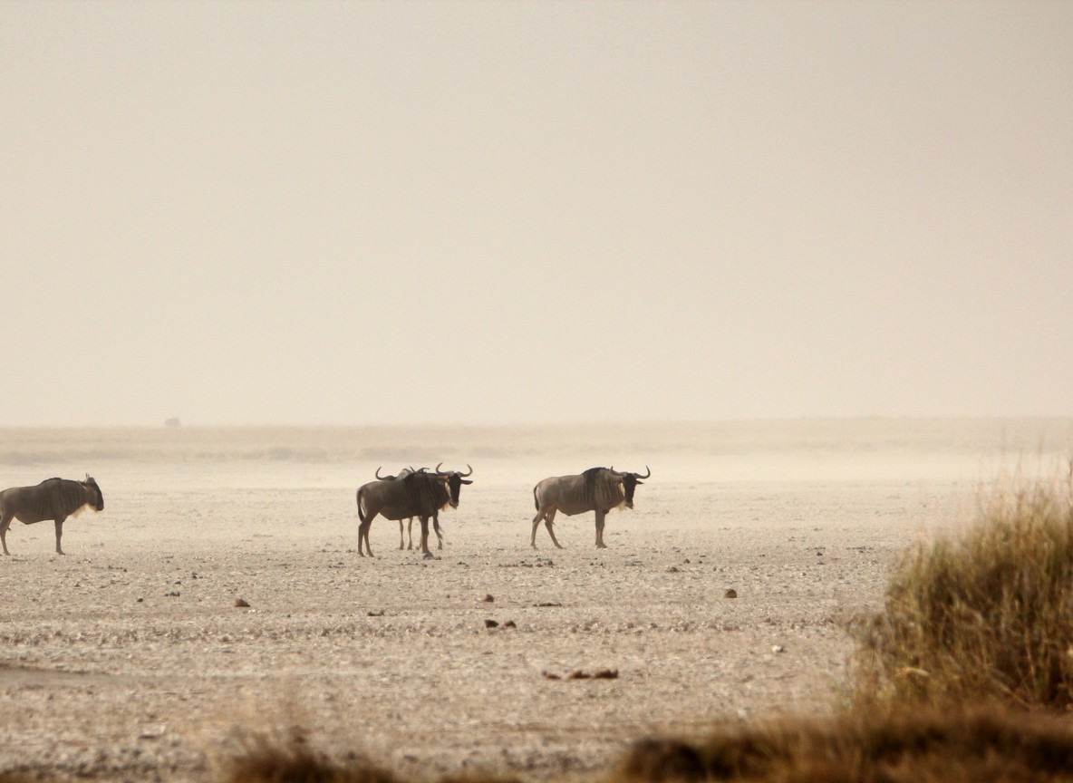
Wildlife in the Chalbi is sparse by reserve standards but present. Grevy’s zebra range across the periphery. Oryx move through in small groups. Predators occasionally follow livestock movements across the northern section. Bird activity concentrates around water sources and seasonal flooding events. The experience here is geological and cultural before it is zoological, and travelers who arrive expecting classic game-drive density will miss the point of what the Chalbi delivers.
Why Specialist Planning Is Essential
The Chalbi is not a destination where improvisation works in your favor. Three factors make proper preparation non-negotiable.
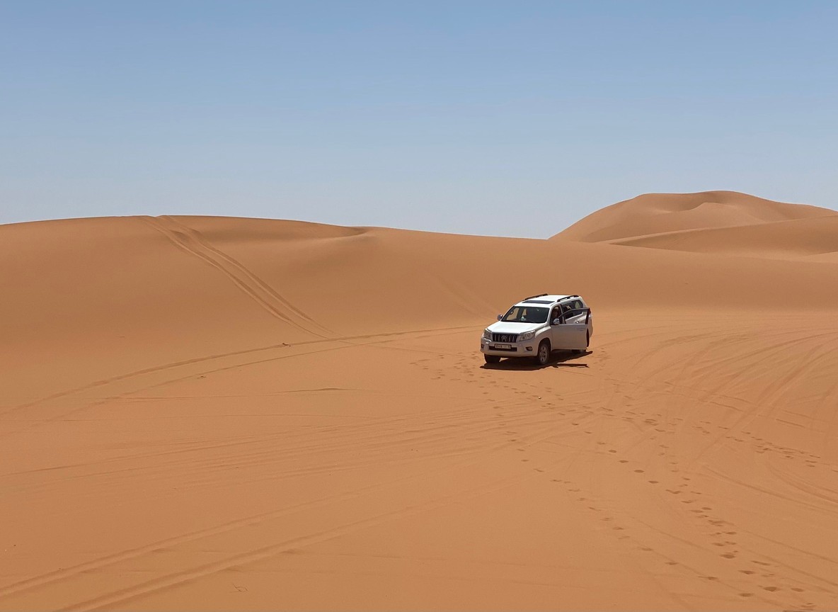
First, distances are genuinely long. From Marsabit town to North Horr is approximately 120 kilometers of track that can take anywhere from two to five hours depending on surface conditions and vehicle type. From North Horr to Loiyangalani on the Lake Turkana shore is a further 100-plus kilometers through terrain where road conditions can deteriorate rapidly and without obvious warning.
Second, resupply is limited. Fuel, water, and food are available in Marsabit and North Horr, but options thin out sharply beyond these points. A properly prepared Chalbi expedition carries fuel margins for double the estimated consumption, minimum water reserves for two days per person beyond the itinerary requirement, and food that does not depend on refrigeration.
Third, communication coverage is inconsistent. Safaricom signal exists in Marsabit town and around North Horr, but drops out across much of the open pan and in the valley corridors between the hills. Expeditions without satellite communication capability are relying on the hope that nothing goes wrong in the areas where phone coverage does not reach.
A capable support vehicle, a driver with specific Chalbi experience, and a communication plan that does not assume cellular coverage are baseline requirements, not premium extras.
Best Time for a Chalbi Expedition
January to March is the most reliable window for Chalbi access. The first dry season keeps the salt pan firm, temperatures are manageable for early morning and evening movement, and road tracks through the zone are at their most predictable. January and February are particularly strong.
June to October is the preferred window for many operators running northern circuits. The second dry season delivers similar surface conditions to the January to March period, with July through September considered the most consistent months across the board.
November to early December can work with a more conservative approach. The short rains sometimes affect the Chalbi, but the event is usually shorter and less intense than the long rains. Travelers who confirm current conditions before departure can often proceed with minor itinerary adjustments.
April to May is the highest-risk period. The long rains can render large sections of the Chalbi impassable, and the approach tracks from Marsabit can also deteriorate significantly. Travelers with specific reasons to visit during this window should carry genuine flexibility for route changes and add minimum two buffer days to any segment that crosses the open pan.
Regardless of month, confirming actual surface conditions via an operator or community contact in the week before travel is worth the effort. The Chalbi’s behavior can differ significantly from Nairobi-level weather forecasts.
Route Options and Circuit Pairings
The Chalbi is almost always part of a broader northern circuit rather than a standalone destination. Its geographic position makes it a natural bridge between Marsabit in the south and the Lake Turkana corridor to the west and northwest.
Short Chalbi exposure involves skirting the southern or eastern edge of the pan without a full crossing. This works well for travelers who want the landscape experience without the logistical commitment of a complete traverse. Camp near North Horr, spend a morning on the pan, and return to Marsabit as the base.
Full pan crossing connects Marsabit to Loiyangalani via North Horr and the western edge of the desert. This is the classic Chalbi route and the most demanding in terms of logistics and time. It works best as part of a Lake Turkana itinerary where Loiyangalani is a planned stop.
Hybrid programs mix short Chalbi segments with fly-in sectors on longer legs. Travelers who want the Chalbi experience but cannot allocate the road days for a full traverse can fly in to a northern airstrip, access the pan from nearby, and continue by air rather than road.
For most first-time Chalbi visitors, the short exposure or a hybrid structure gives a more balanced experience than an aggressive full-crossing plan, particularly when road time across the region is already significant.
Packing and Field Readiness for Desert Conditions
Desert travel demands a different preparation approach from standard safari packing. The key variables are temperature range, dust, sun exposure, and water management.
Temperature swings in the Chalbi are pronounced. Dawn temperatures can drop to 15 degrees Celsius or lower in the cooler dry season months. By midday, exposed terrain can reach 40 degrees. Layered clothing that allows rapid adjustment is more practical than packing for a single temperature band. A lightweight but genuinely warm fleece for early mornings, combined with breathable, full-coverage sun protection for midday movement, covers the range without excessive weight.
Dust management is important for optical equipment. Camera bodies and lenses should travel in dry bags or sealed pouches between active use. Filter systems protect lenses from abrasive particles during longer open-vehicle segments. Dust also infiltrates vehicle storage compartments, so personal items in soft bags are better organized in smaller, closeable modules rather than open packing.
Water consumption in desert heat is higher than most travelers anticipate. A conservative planning figure for active movement days is four to five liters per person. Hydration reserves should exceed daily requirements by at least 50 percent to account for delays, unexpected heat, and the possibility of an additional unplanned overnight.
Sun protection on open terrain is not optional. A wide-brim hat, UV-blocking sunglasses, and high-SPF coverage for exposed skin should be in your kit regardless of cloud cover.
Safety and Support Standards
The difference between a successful Chalbi expedition and a serious problem is almost always the quality of preparation and support rather than the behavior of conditions on the day. Travelers evaluating operator proposals for Chalbi segments should ask specifically about the following.
Vehicle recovery capacity: at minimum a high-lift jack, sand ladders, tow straps, and a driver trained in their use. Dual-vehicle formats where one vehicle can recover the other are significantly safer than solo-vehicle crossings.
Satellite communication: a satellite phone or messenger device that functions independently of cellular networks. This is particularly important for the open pan crossing and for segments through the Huri Hills corridor.
Water and fuel margins: the operator should be able to state specifically how much excess fuel and water the vehicles carry relative to route requirements. “Plenty” is not an answer; numbers are.
Emergency and evacuation protocol: who is contacted, in what order, and what the realistic response time is for a medical evacuation from the Chalbi or North Horr area.
These are not excessive demands. Any operator running this corridor professionally will have clear, documented answers to all of them.
A Sample 4-Day Chalbi Segment
This framework fits a Marsabit-entry, Loiyangalani-exit routing and gives realistic pacing for the traverse.
Day 1: Arrive Marsabit after the Isiolo road section. Full vehicle and systems check. Afternoon walk in Marsabit forest or crater-lake orientation. Early overnight at Marsabit.
Day 2: Pre-dawn departure to cross the Chalbi section before midday heat peaks. Stop at North Horr for fuel and community interaction. Afternoon at camp near the western edge of the pan or in the approach to Loiyangalani. Guided interpretation of geological and cultural features during drive.
Day 3: Second field day with route flexibility built in. This day holds the buffer for any first-day delays, surface complications, or weather-related route adjustments. Can be used for a morning return to a specific pan area for photography or wildlife movement if Day 2 conditions were good.
Day 4: Controlled exit toward Loiyangalani for Lake Turkana arrival, or reverse direction back to Marsabit depending on overall itinerary.
Keeping this format at four days with a genuine buffer on Day 3 prevents the kind of rushed decision-making that causes most preventable problems on Chalbi expeditions.
Engaging with Gabbra and Rendille Communities
The communities living in and around the Chalbi, primarily Gabbra pastoralists and sections of the Rendille people, have managed this environment for centuries through a sophisticated understanding of water points, seasonal movement, and landscape behavior that no satellite map can replicate. Travelers who approach community interaction with respect and genuine curiosity will gain context for the landscape that makes the physical experience significantly richer.
North Horr market days bring together traders, herders, and families from across the northern reaches of the Chalbi zone. Visiting on a market day provides a social portrait of this part of Kenya that is completely absent from wildlife-focused itineraries. Scheduling around the market calendar is a minor logistical consideration with a disproportionately large experiential payoff.
Practical Planning Notes
The Chalbi works best for travelers who have already done a more conventional Kenya safari or who are explicitly seeking an expedition experience rather than a comfortable wildlife viewing holiday. It is not a destination to parachute into as a first Kenya trip without significant preparation and a realistic mindset.
That said, travelers who approach it properly consistently rank the Chalbi among the most memorable segments of their Kenya experience, not despite its austerity but because of it. There is nothing quite like watching the sunrise over a white salt pan in northern Kenya, knowing that the nearest conventional tourist is likely two days’ drive away.
Conclusion
Planning a Chalbi Desert expedition means committing to a trip that prioritizes landscape, culture, and physical experience over sighting density and itinerary predictability. The reward is proportionate to the preparation. Travelers who arrive with the right vehicle support, realistic timing, appropriate kit, and an honest understanding of the terrain will find that the Chalbi delivers something the rest of Kenya’s safari circuit simply cannot replicate.
Reader Next Steps
The Chalbi connects naturally with the Lake Turkana corridor to the west. The Tourinsights Lake Turkana safari guide covers the Loiyangalani segment and lake access in detail. Travelers building a broader northern circuit should also read the Marsabit National Park guide for the highland approach to the Chalbi zone. Timing guidance for all northern Kenya routes is covered in the month-by-month northern Kenya conditions guide. For full expedition logistics and supported route planning, Trunktrails Safaris runs northern circuits that include Chalbi segments.