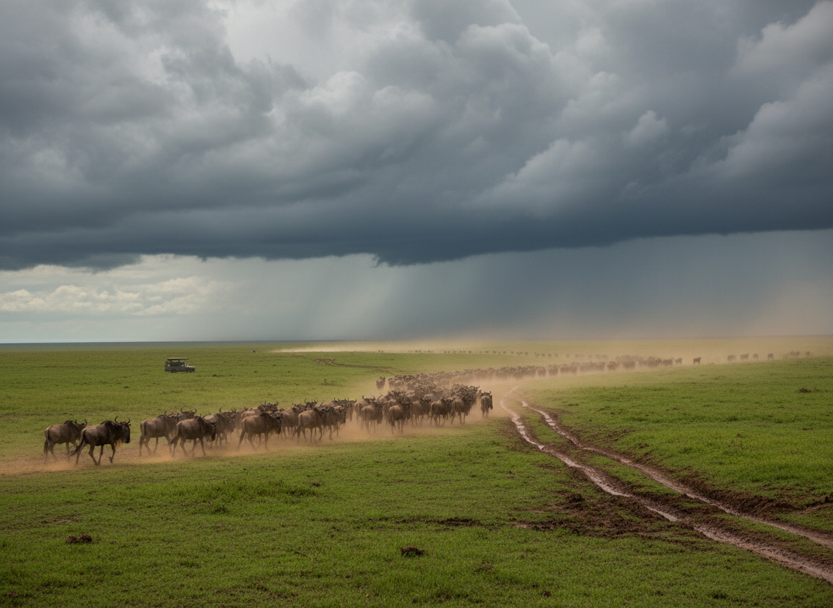
Look at a satellite image of the Serengeti-Mara ecosystem and hold it for a moment. What appears to be open savanna is a 30,000-square-kilometre system that 1.5 million wildebeest have been walking in a clockwise loop for hundreds of thousands of years. The wildebeest do not travel alone: roughly 200,000 zebra and 300,000 Thomson’s gazelle move with them for much of the circuit, drawn by the same fresh grass, with zebra often leading into new grazing since they eat the coarse top growth the wildebeest leave behind.
The wildebeest migration route is among the most studied animal movement patterns on Earth, and still one of the least fully understood. The broad circuit is predictable. The precise timing within each stage is not. And the specific crossing points where animals commit to swimming the Mara River under crocodile pressure are different every season.
This guide traces the full route, explains what drives each phase of movement, and identifies where to position yourself for the most significant wildlife moments.
The Full Circuit: Overview
The migration follows a clockwise loop across the Serengeti National Park in Tanzania and the Masai Mara National Reserve in Kenya. The annual circuit covers roughly 1,800 kilometres per individual animal, though many cover considerably more due to back-and-forth movement within sections.
The five stages of the route:
- Southern Serengeti, Tanzania (January to March): calving grounds
- Central Serengeti (April to May): northward movement through the long rains
- Northern Serengeti and Lobo area (June): approach to Kenya
- Masai Mara, Kenya (July to October): Mara River crossings and peak grazing
- Return south (November to December): short rains trigger the southward movement
The wildebeest do not move as a single block. They travel in columns and clusters that can extend for dozens of kilometres. The leading edge and the trailing edge of the herd can be weeks apart in calendar time.
Stage 1: The Calving Grounds, Southern Serengeti
Where: Ndutu plains and short-grass areas of the southern Serengeti, Tanzania
When: January to March
The annual circuit begins in the southern Serengeti, where approximately 500,000 calves are born within a concentrated six-week window. This synchronized mass birth strategy floods the system with more calves than the predator population can consume. Individual calves are at extreme risk; the species survives through scale.
The southern Serengeti calving grounds are the most fertile section of the ecosystem: short-grass plains fed by volcanic soils and reliable short rains. Wildebeest concentrate here specifically because the grass is nutritious enough for lactating females and their newborns.
Movement at this stage is minimal. The herds are relatively stationary during peak calving.
For travelers, calving season is one of the two peak wildlife windows in the Serengeti-Mara system. The predator density, particularly cheetahs, hyenas, and lions, is extraordinary. It requires a Tanzania portion of an itinerary and does not overlap with the Mara River crossing season.
Stage 2: The Northward Push, Central Serengeti
Where: Central Serengeti corridor, Tanzania
When: April to May
As the long rains arrive and the southern plains grass is grazed out, the herds begin moving north through the central Serengeti. This is the least-visited phase of the migration. Long rains make roads difficult and tourism infrastructure sparser. But the predator action around moving columns of vulnerable young calves is extraordinary for guests willing to manage wet-season conditions.
The Grumeti River, a smaller and less famous counterpart to the Mara River, provides the first river crossing event of the annual cycle, typically in May or June. Grumeti crossings are less dramatic in scale than the Mara crossings, but the close-encounter intensity is comparable.
Stage 3: Approach to Kenya, Northern Serengeti
Where: Northern Serengeti, Lobo and Klein’s Gate areas, Tanzania
When: June
By June, leading columns are pushing into the northern Serengeti. The Mara River forms the Kenya-Tanzania border at this point, and the first crossing attempts into Kenya begin in mid to late June.
The northern Serengeti in June is an increasingly popular alternative to the Masai Mara for travelers who want crossing drama with lower visitor numbers and competitive camp pricing. The trade-off is infrastructure: the northern Serengeti has fewer camps and less development than the Kenya side.
Stage 4: The Masai Mara, Kenya’s Chapter of the Route
Where: Masai Mara National Reserve and surrounding community conservancies, Kenya
When: July to October
This is the stage that defines the Great Migration in popular imagination. The herds cross into Kenya and encounter the Mara River running across their path. To continue north, they must enter the water.
The Mara River Crossing Points
The Mara River has multiple crossing points where the wildebeest concentrate in different seasons. The most active sites shift year to year and even week to week depending on herd density, river levels, and bank conditions.
Purungat Bridge area (Crossing 1): The most frequently used crossing in the central Mara. Multiple viewing angles and relatively easy road access make it the most visited crossing point. During August peak season, vehicle numbers here can be high.
Sand River crossing: On the Kenya-Tanzania border, used when large columns are moving between the two countries. Often sees less vehicle pressure than the central crossings.
Lookout Hill and Ol Kiombo area: Northern Mara crossing points used when herds are concentrated in the conservancy sections. Generally the most exclusive viewing, as conservancy vehicle limits apply.
Mara Triangle crossings: The western section of the Mara, managed separately by the Mara Conservancy. Known for high predator density and excellent sightlines at crossing points. Worth the extra drive time from central Mara camps.
The Mara River: Physical Facts
The Mara River originates in Kenya’s Mau Forest and flows westward through the Mara Triangle before turning south across the Tanzanian border. It is approximately 395 kilometres long. At the crossing zones, the river ranges from 20 to 80 metres wide, with seasonal depths of 1 to 4 metres.
The Nile crocodile population in the Mara River is among the densest in Africa. Large individuals reach 5 to 6 metres. They congregate at known crossing points in advance of the migration herds and are selective in their predation, typically targeting isolated or exhausted animals rather than attacking the main column directly. Their predation success rate during crossings is estimated at 3 to 5 percent of animals attempting a crossing: low enough that the population survives, high enough that the drama is real.
Stage 5: The Return South
Where: The return crosses through northern Serengeti back to the southern plains
When: November to December
As the short rains regenerate fresh grass in the southern Serengeti, the herds begin returning south in November. The southward crossings of the Mara River receive less attention than the northward crossings but are equally dramatic for guests in Kenya during October and early November.
The return movement is less concentrated than the northward push. Herds spread across a wider front and may take different routes south depending on where rainfall is occurring.
Conservation and the Route
The wildebeest migration route functions only because the entire 30,000-square-kilometre ecosystem remains intact and connected. Remove any section through fencing, agriculture, or infrastructure development, and the circuit breaks.
This is why the Maasai community conservancies surrounding the Masai Mara are critical to the migration’s long-term survival. The route passes directly through Maasai community land north and east of the national reserve. If those communities converted their land to agriculture, the Kenya chapter of the migration would effectively end.
The conservancy model, where Maasai landowners receive income from tourism in exchange for keeping their land open to wildlife, is one of the most important conservation mechanisms in East Africa. Travelers who book conservancy camps contribute directly to making that model financially viable.
Explorer Notes: Using Route Knowledge to Plan Your Safari
Timing your visit around the route: The route calendar above is a general guide, not a guaranteed schedule. Early rains in the south can pull the herds back several weeks earlier than expected. Late rains can push arrival in Kenya into August or September. A local operator checking current conditions in the weeks before your travel provides more useful guidance than any published timetable.
Northern Serengeti as an alternative: For travelers who cannot be in Kenya in July through October, the northern Serengeti offers crossing drama in June with significantly fewer vehicles. The trade-off is infrastructure and access; it requires a Tanzania-focused itinerary.
Camp placement matters more than camp category: Being 15 minutes from an active crossing point is more valuable than being in a luxury tent that is 45 minutes away. Ask your operator directly how far each shortlisted camp is from the Purungat Bridge area and the Sand River crossing before you decide.
Crossing points move: The most active crossing point in August may not be the most active in September. Experienced guides use radio networks, early morning track reading, and predator movement to judge which section of the river the herds are using on any given day. This local intelligence is not available from online trackers.
Conclusion
The wildebeest migration route is a clockwise loop driven by rainfall, grass quality, and the need to keep 1.5 million animals fed across a 30,000-square-kilometre ecosystem. Understanding the full circuit, from the calving grounds in the southern Serengeti through the Grumeti crossings, the Mara River crossing season in Kenya, and the return south in November, gives you the context to plan a visit around the moments that matter most to you.
The circuit is predictable in structure. The timing within it is always a negotiation with the weather.
Related Reading
- Wildebeest migration facts: 20 things that reframe the experience
- What to expect on a migration safari in Kenya
- Wildebeest migration safari Kenya: the complete planning guide
- How migration trackers work and what they can and cannot tell you
- For camp selection and route-based timing advice, Trunktrails Safaris operates in both the Masai Mara National Reserve and the community conservancies, with local guides who track conditions daily.
Prefer a different route, budget, or travel style? This plan can be adapted to fit.
Customise Your TripFurther reading
More safari planning resources
- Wildebeest migration route map from Valley Safaris
- Great Migration safari collection on FindMySafari
- Interactive Maasai Mara map from Valley Safaris
- Best time to visit Kenya month-by-month map from Valley Safaris