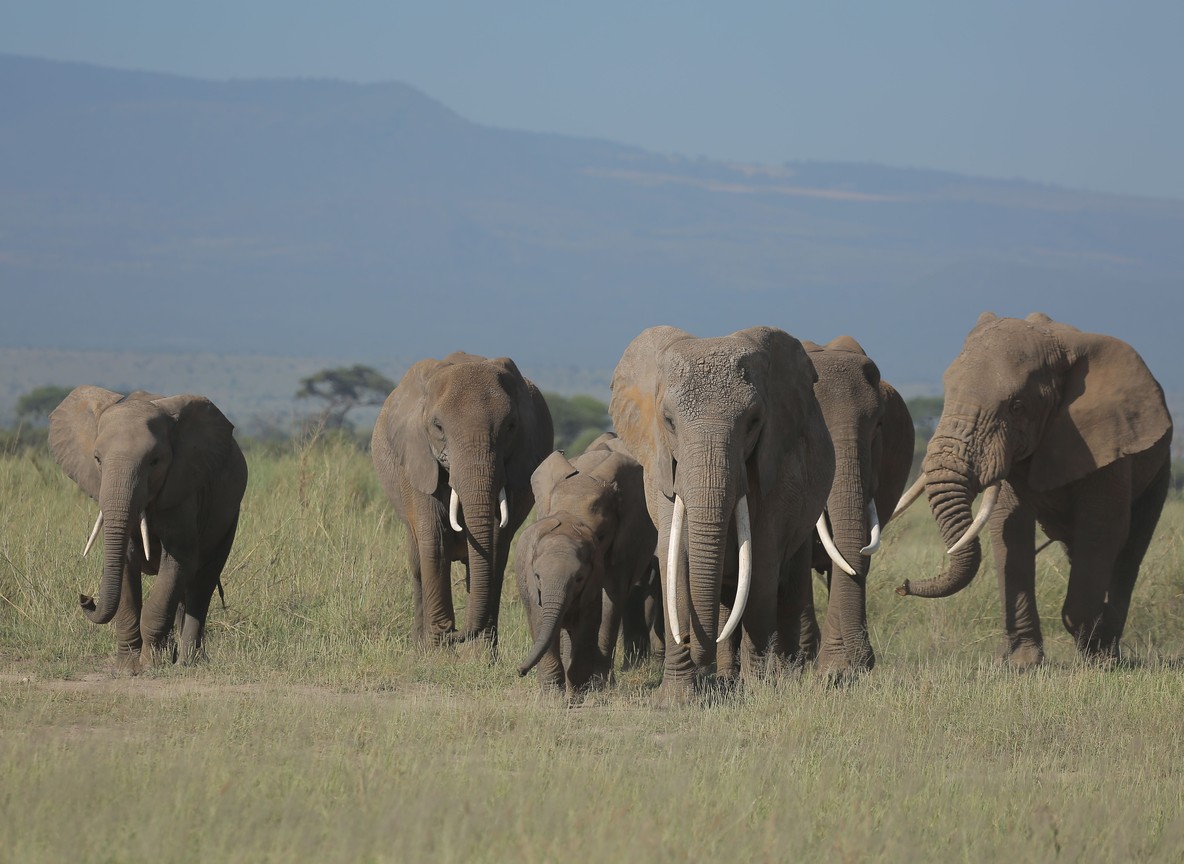
Most visitors to Kenya’s north have never heard of Nasolot National Reserve, and that is exactly why it holds elephants the way it does. Gazetted in 1979 and tucked against the Turkwel Gorge in West Pokot County, this 92 km2 reserve carries an estimated 300 elephants as of 2024, a striking number for a park this size. No lodge sits inside its boundary and no safari convoy passes through on a standard itinerary. This guide covers what makes Nasolot worth the detour, how to reach it, what else lives there, and where to base yourself for the trip.
What Makes Nasolot National Reserve Different
Nasolot covers roughly 92 km2 of dry savannah, thorn scrub, and gallery forest along the Turkwel River in northwest Kenya. The reserve takes its name from Nasolot Hill, a steep-sided landmark that dominates the skyline and offers views toward the Sekerr Range and Mount Mtelo to the south. The Turkwel River cuts through the reserve and feeds the Turkwel Hydroelectric Dam just beyond its border, giving the landscape a permanent water source that most of West Pokot’s drier country lacks. That water is the reason the wildlife concentrates here instead of scattering across the wider region.
The Elephants of Nasolot and the Masol Corridor
Nasolot’s elephant population, estimated at around 300 animals in 2024, is not isolated. The reserve sits at one end of the Masol corridor, a traditional migration route elephants use to move between Nasolot, Rimoi National Reserve, and South Turkana National Reserve. Herds shift along this corridor with the seasons, following rainfall and forage rather than staying fixed inside any one reserve’s boundary. That connectivity is part of why conservationists treat Nasolot as more than a small, standalone park. It functions as one node in a chain of reserves that together give elephants room to roam across three counties.
Wildlife Beyond the Elephants
Elephants draw the headline, but Nasolot’s species list runs longer. Buffalo, lion, leopard, and spotted hyena share the bush with lesser kudu, bushbuck, duiker, dik-dik, and impala. Beisa and fringe-eared oryx, both increasingly hard to find elsewhere in Kenya, still turn up here in reasonable numbers. Waterbuck and hippo stay close to the Turkwel River, and Thomson’s gazelle graze the more open stretches near Nasolot Hill. Olive baboons and sykes and vervet monkeys move through the riverine forest along the water, usually in noisy troops that are easier to hear than see. Birders should watch for secretary birds and several eagle species working the grassland edges, plus ibis feeding along the riverbank at dawn. The Turkwel River itself holds Nile perch and catfish, drawing anglers along with wildlife watchers, though fishing here is informal and not set up for visiting tourists the way it is on Lake Turkana.
Poaching pressure and habitat degradation are ongoing concerns for a reserve this size, and Kenya Wildlife Service rangers patrol the boundary in coordination with community scouts from surrounding West Pokot villages. That community link matters more here than at a headline park. Nasolot has no fence, so elephants regularly cross onto grazing land outside the reserve, and local goodwill toward the animals affects how well the Masol corridor keeps functioning over time.
Getting to Nasolot National Reserve
The most direct route runs north from Kitale on the A1 Kitale-Lodwar highway. Sarmach Gate sits roughly 146 km along that road, reached by turning off the A1 and driving a further 6 km to the entrance. Travelers coming from the Kainuk-Turkwel junction have a shorter run, about 10 km to the reserve boundary. Three airstrips serve the wider area for charter flights: Turkwel Dam Station, Marich Pass, and Kaputir, though none run scheduled commercial service. A 4WD vehicle is the practical choice for the final stretch, since the reserve’s internal tracks are unpaved and can wash out after rain.
Nasolot vs Other Quiet Rift Valley Reserves
Nasolot is one of several small, lightly visited reserves scattered across West Pokot, Elgeyo Marakwet, and Turkana counties. The table below lines it up against three comparable spots so travelers can weigh size, access, and signature wildlife before choosing a route.
| Reserve | County | Size | Access from Kitale | Signature draw |
|---|---|---|---|---|
| Nasolot National Reserve | West Pokot | 92 km2 | 146 km north via A1 to Sarmach Gate | ~300 elephants, Masol migration corridor |
| Rimoi National Reserve | Elgeyo Marakwet | 66 km2 | ~40 km from Iten off the Eldoret-Iten-Kabarnet road | Elephant herds up to 50, Kerio Valley views |
| South Turkana National Reserve | Turkana | 1,091 km2 | ~98 km north via A1 toward Lodwar | Mount Nasolot foothills, crocodile-lined Kerio riverbed |
| Saiwa Swamp National Park | Trans Nzoia | 2.9 km2 | ~18 km north of Kitale | Sitatunga antelope, walking-only trails |
Entry fees for Nasolot are not published at the same headline level as Kenya’s major parks. Based on comparable small KWS reserves in the region, budget an indicative $15-25 per person per day for non-residents, and confirm the current rate directly with Kenya Wildlife Service or a Kitale-based operator before you travel, since rates and payment channels change.
Where to Stay Near Nasolot
No lodge or campsite operates inside Nasolot itself, so accommodation means basing outside the gate. Marich Pass Field Studies Centre, about 80 km away, is a long-running research and education camp that also takes independent travelers, with simple bandas and a campsite. Mount Mtelo View Lodge, roughly 30 km from the reserve, sits closer and works well as a one-night base before an early game drive. Travelers building a longer West Pokot loop often combine a Nasolot stop with a night in Kitale, about 2.5 hours south by road, where more hotel choices exist. Kitale also gives access to fuel, vehicle repairs, and a wider choice of drivers familiar with the Kitale-Lodwar road, all of which matter more on a route this remote than they would closer to Nairobi.
Best Time to Visit and What to Bring
The dry months, January to March and June to September, give the clearest wildlife viewing and the most reliable road conditions on the approach from Kitale. Wet season travel, especially April, May, and November, brings a real risk of washed-out sections on the unpaved stretch beyond Sarmach Gate, so a 4WD vehicle and a local driver-guide are worth arranging rather than self-driving blind. Pack for heat. West Pokot’s lowland stretches near the Turkwel Gorge run hot and dry most of the year, so light clothing, a wide-brim hat, and more water than you think you need all matter more here than they do in the cooler Mara highlands.
Explorer Notes
Ask at Sarmach Gate about recent elephant movement along the Masol corridor before setting out; rangers track herd positions informally and can point you toward the stretch of river where sightings have been strongest that week. The gallery forest lining the Turkwel River holds shade and water in the heat of the day, so mid-morning and late afternoon game drives along the riverbank tend to outperform a midday loop near Nasolot Hill. Fuel up in Kitale before heading north. There are no reliable fuel stops between Kitale and the reserve, and running low on the unpaved final stretch is a genuine risk, not a minor inconvenience.
Frequently Asked Questions
Where is Nasolot National Reserve located? Nasolot sits in West Pokot County in northwest Kenya, near the Turkwel Gorge and roughly 146 km north of Kitale along the A1 Kitale-Lodwar highway.
How many elephants live in Nasolot National Reserve? Estimates put the population at around 300 elephants as of 2024. The herds move seasonally along the Masol corridor between Nasolot, Rimoi, and South Turkana National Reserve, so the number present at any one time varies.
Is there accommodation inside Nasolot National Reserve? No. There is no lodge or campsite within the reserve boundary. The nearest options are Mount Mtelo View Lodge, about 30 km away, and Marich Pass Field Studies Centre, about 80 km away.
What is the best way to get to Nasolot National Reserve? Drive north from Kitale on the A1 Kitale-Lodwar highway to Sarmach Gate, about 146 km plus a 6 km turnoff. A 4WD vehicle is recommended, especially outside the dry season.
Can you fly into Nasolot National Reserve? There is no scheduled commercial service, but charter flights can use one of three nearby airstrips: Turkwel Dam Station, Marich Pass, or Kaputir.
Nasolot will not fit neatly into a first-time Kenya itinerary built around the Mara and Amboseli, and it is not trying to. It rewards travelers who already have a northern Rift Valley route in mind and want a genuinely quiet elephant reserve added to it. If West Pokot or the wider Turkwel-Turkana circuit is on your radar, check Touring Insights’ Tour Packages page for operators running routes through this region. A partner planner can also help slot Nasolot into an existing northern Kenya itinerary.
What to Read Next
- Curious about the sitatunga, Kenya’s other single-species reserve draw further south in Trans Nzoia? Read our Saiwa Swamp guide.
- Planning a longer swing toward Lake Turkana after West Pokot? See our Central Island National Park boat access guide.
- Weighing whether a northern Kenya safari is safe and practical this year? Check our Kenya travel advisory by safari county breakdown.