Short answer: yes, for the counties where safaris actually happen. That answer only means something once you read what the US State Department and the UK Foreign, Commonwealth and Development Office (FCDO) actually say. The headline version circulating on forums and social feeds skips the detail. Both agencies publish region-by-region guidance for Kenya, not a single yes-or-no verdict. Touring Insights checked both documents against the counties that hold Kenya’s main parks. Below, you can see exactly where the flagged areas sit and how far they are from the Masai Mara, Amboseli, and Tsavo. We do not operate tours ourselves; this is a planning reference, not a booking pitch.
What the US State Department Says About Kenya Right Now
The US State Department rates Kenya at Level 2, “Exercise Increased Caution,” for the country as a whole. That tier sits in the middle of a four-level scale and covers a long list of popular destinations worldwide, not just Kenya. It reflects general crime risk, the kind found in most large cities, rather than a warning to avoid the country.
Underneath that baseline, the advisory carries sharper regional flags. It rates Garissa, Wajir, and Mandera counties at Level 4, “Do Not Travel.” The same rating covers the Kenya-Somalia border strip and the Boni Forest area near Lamu‘s mainland. Eastleigh, a specific Nairobi neighborhood, and Kenya’s counties bordering South Sudan and Ethiopia carry Level 3, “Reconsider Travel.” Terrorism risk and armed banditry drive both ratings. None of these zones sit anywhere near the safari circuit.
What the UK FCDO Says About Kenya Right Now
The FCDO uses a different scale but reaches a similar geographic picture. Most of Kenya falls under standard travel advice: normal precautions apply. That covers Nairobi’s main districts, the coast south of Malindi, and every major safari park. It is the same guidance the FCDO gives for most international destinations.
The FCDO advises against all travel to a strip within roughly 60 km of the Kenya-Somalia border, plus Eastleigh in Nairobi and the Boni Forest area. It advises against all but essential travel to the rest of Garissa, Wajir, Mandera, and Tana River counties. That tier also covers mainland Lamu outside the town and island, plus parts of Turkana and West Pokot, where cattle-rustling violence flares periodically. Again, these zones cluster in Kenya’s north and northeast, far from Narok, Kajiado, and Taita-Taveta counties.
Where the US and UK Advisories Agree
Lay the two documents side by side and the overlap is striking. Both flag the same border counties for the same reasons: terrorism risk tied to the Somali border and banditry in remote pastoral areas. Neither singles out the counties that hold Kenya’s safari parks.
| Region | US State Dept Rating | UK FCDO Advice | Approx. Distance from Nairobi (JKIA) |
|---|---|---|---|
| Mandera County | Level 4, Do Not Travel | Advise against all travel | ~880 km |
| Wajir County | Level 4, Do Not Travel | Advise against all but essential travel | ~640 km |
| Garissa County (border strip) | Level 4, Do Not Travel | Advise against all travel (border strip) | ~370 km |
| Eastleigh, Nairobi | Level 3, Reconsider Travel | Advise against all travel | ~7 km |
| Turkana County | Level 3, Reconsider Travel | Advise against all but essential travel (parts) | ~700 km |
| Lamu mainland (north of Tana River) | Level 4, Do Not Travel | Advise against all travel | ~600 km via Malindi |
| Narok County (Masai Mara) | Not flagged, Level 2 baseline | Normal precautions | ~270 km |
| Kajiado County (Amboseli) | Not flagged, Level 2 baseline | Normal precautions | ~230 km |
| Taita-Taveta County (Tsavo) | Not flagged, Level 2 baseline | Normal precautions | ~330 km |
Every elevated-risk zone sits at least 370 km from Nairobi, in the opposite direction from where safari vehicles drive. The three counties carrying Kenya’s headline parks appear in neither document’s flagged list.
What “Do Not Travel” Zones Actually Cover
The Level 4 and “advise against all travel” zones follow Kenya’s northern and northeastern borders, where the country meets Somalia, Ethiopia, and South Sudan. Mandera sits at the point where all three borders converge. Garissa and Wajir lie closer to the Somali border further south. These are remote, sparsely populated areas built around cross-border trade and pastoral herding, not tourism infrastructure.
Eastleigh is the one exception worth naming specifically, since it sits inside Nairobi rather than out on a border. It is a commercial district a short drive from the city center, unrelated to any airport transfer route, hotel district, or safari departure point a typical visitor would use. Flights from Jomo Kenyatta International Airport and safari transfers from Wilson Airport do not route through it.
Does a Travel Advisory Affect Your Insurance?
This is the part most safety guides skip, and it matters more than the headline rating. Many travel insurance policies exclude claims for trips into a “Do Not Travel” or “advise against all travel” zone. That exclusion is regional, not national. A claim tied to an incident in Nairobi or the Masai Mara is not affected by a Do Not Travel rating on Mandera County, hundreds of kilometers away.
Check your policy wording before you buy it, not after a claim gets denied. Look for how the insurer defines “affected area.” Some insurers tie coverage to the advisory as published on your booking date. Updates issued after that date may not change your coverage retroactively. If your itinerary stays within Narok, Kajiado, or Taita-Taveta counties, this should be a formality rather than an obstacle.
What Safari Travelers Should Actually Check Before Booking
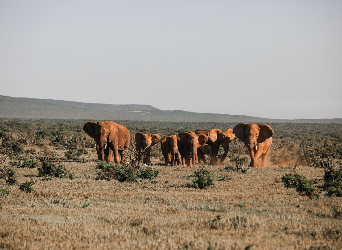
A safari built around the Masai Mara, Amboseli, or Tsavo sits outside every flagged zone in both the US and UK advisories. That covers the standard first-time itinerary: predator sightings and the wildebeest migration in the Mara, elephant herds under Kilimanjaro in Amboseli, and Tsavo’s red-earth landscapes.
Standard precautions still apply, the same ones sensible anywhere unfamiliar. Use a licensed operator or your camp’s own transfer rather than an unmarked taxi. Register your trip with the US State Department’s STEP program or the UK’s “Travel Aware” resources if your government offers it. Keep valuables secured and your documents backed up digitally. None of that is specific to Kenya. It is baseline sense for any international trip.
Trip-Planning Facts Worth Knowing
| Fact | Detail |
|---|---|
| Masai Mara National Reserve size | ~1,510 km² |
| Amboseli National Park size | ~392 km² |
| Tsavo East and Tsavo West combined size | ~22,800 km² |
| Nairobi (JKIA) to Sekenani Gate, Masai Mara | ~270 km road, 5-6 hours |
| Wilson Airport to Mara airstrips (Musiara, Keekorok, Ol Kiombo) | ~45 minutes flight |
| Nairobi to Amboseli (Meshanani Gate) | ~230 km road, ~4 hours |
| Nairobi to Tsavo West (Mtito Andei Gate) | ~230-260 km road, ~3.5 hours |
| Non-resident Masai Mara entry fee | approx. USD 200 per adult per day (indicative) |
| US State Dept overall Kenya rating | Level 2, Exercise Increased Caution |
| UK FCDO default for main safari counties | Normal precautions |
Park fees and gate procedures shift with county authority reviews, so treat the entry figure as an indicative range. Confirm the current rate with your operator or the Narok County reserve office before travel.
Explorer Notes
Guides working the Mara, Amboseli, and Tsavo circuits rarely get questions about the border counties, since itineraries almost never route near them. When a guest does ask, the practical answer is simple: those zones sit closer to Mogadishu or Juba than to any camp gate on the safari circuit. Camps also track small local updates, like a road closure or a county event, through their own ground network. That network usually moves faster than a national advisory does. If a specific stretch of road worries you, ask your ground operator directly before you fly. They run that route weekly and know current conditions better than a document on a fixed review cycle.
What to Read Next
- Curious how a different country reads the same picture? See our Canada advisory and safari counties breakdown.
- Heard the Masai Mara rumors? Read our hostage rumor explainer.
- Traveling solo? Check our Nairobi safety guide for solo travelers.
Frequently Asked Questions
Is Kenya safe for a safari in 2026? Yes, for the standard safari counties. Narok (Masai Mara), Kajiado (Amboseli), and Taita-Taveta (Tsavo) appear in neither the US State Department’s nor the UK FCDO’s flagged zones.
What does the US State Department rate Kenya overall? Level 2, “Exercise Increased Caution,” the same middle tier applied to many popular travel destinations. Specific border counties carry a stricter Level 4 rating.
Does the UK FCDO advise against travel to Kenya? No, not for the country as a whole. It advises against travel to specific zones near the Somalia border and one Nairobi neighborhood, while the rest of the country, including the safari parks, carries standard advice.
Will a Kenya travel advisory affect my travel insurance? Only if your itinerary enters a flagged zone. Coverage exclusions are regional, tied to the specific area rated Do Not Travel, not the whole country. Check your policy wording before booking.
Should I still take safety precautions on a Masai Mara or Amboseli trip? Yes. Use a licensed operator, secure your valuables, and register your trip with your government’s travel program. These are standard steps for any international trip, not a Kenya-specific concern.
Planning a Masai Mara, Amboseli, or Tsavo itinerary and want current, ground-level guidance before you book? Visit our Tour Packages page or check with a partner operator for the latest conditions on your route.
Further reading
More safari planning resources
- Interactive Maasai Mara map from Valley Safaris
- Maasai Mara National Reserve guide on Touring Insights
- Masai Mara destination guide on FindMySafari
- Map of Amboseli from Valley Safaris
Related guides: Is It Safe to Safari in Kenya Right Now? What the 2026 Ebola Outbreak Advisories Actually Cover.