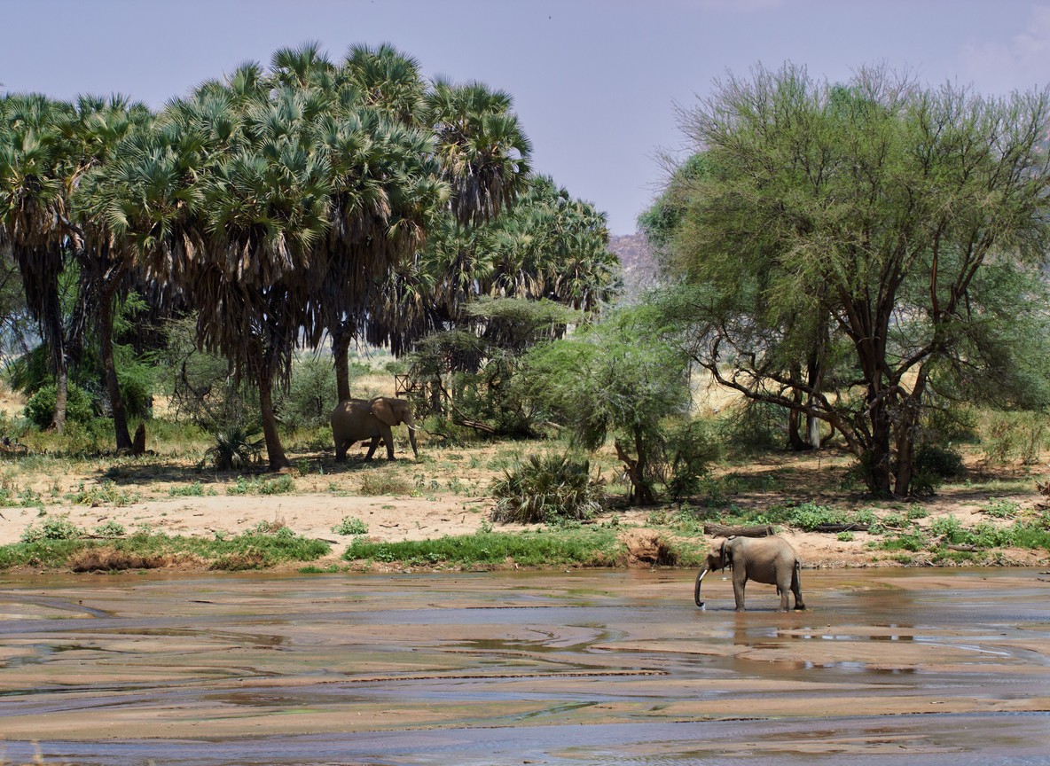
Tsavo runs hotter and drier than the Masai Mara or Amboseli, and that changes how you should plan around it. Kenya’s largest protected area splits into Tsavo East (13,747 km2) and Tsavo West (9,065 km2), together covering roughly 22,800 km2 of semi-arid bush. Touring Insights breaks down what each month actually delivers here, from red-dust elephant herds at Aruba Dam to the underwater hippo chamber at Mzima Springs, so you can match your dates to the trip you actually want.
Why Tsavo’s Calendar Works Differently
Most Kenya safari guides describe four seasons: long rains, long dry, short rains, short dry. Tsavo follows that same rough pattern, but its lower elevation and semi-arid “nyika” bush push temperatures higher and rainfall lower than the Mara or Aberdare highlands. Daytime highs in Tsavo regularly top 30°C even in the cooler months.
That heat concentrates wildlife around permanent water sources for longer stretches of the year than in wetter parks. Aruba Dam and the Galana River in Tsavo East, plus Mzima Springs in Tsavo West, stay reliable draws almost year-round. Rainfall timing still matters for road conditions, bird activity, and how far animals scatter from the rivers.
Tsavo also spans a much bigger footprint than most Kenya parks, so weather can differ between the two halves on the same day. The western park sits higher and closer to the Chyulu Hills, which pulls in slightly more rain than the flatter plains of Tsavo East. Planning a season around Tsavo means planning around both parks, not one uniform climate.
June to October: Long Dry Season, Peak Game Viewing
June through October is Tsavo’s most reliable game-viewing window. Grass dies back, waterholes shrink, and animals cluster along the Galana River, Voi River, and Aruba Dam. Elephant herds coated in Tsavo’s signature red laterite dust gather at these points in large numbers, often in view of a single vehicle for an hour or more.
Daytime temperatures sit around 28-32°C with cooler mornings near 16-18°C. Rainfall drops close to zero most months. Roads firm up across both parks, which matters in Tsavo West‘s rockier terrain near Chyulu Gate. Camps stay busier than the shoulder months, though Tsavo sees far fewer vehicles per sighting than the Mara during this same window.
January to February: The Short Dry Window
A second, shorter dry spell follows Kenya’s November-December short rains. January and February bring clear skies back to Tsavo with daytime temperatures often pushing past 32°C, hotter than the June-October window. Grass from the short rains has not fully dried out yet, so game viewing rewards patience near water rather than open-plain sightings.
This period suits travelers who want dry-season roads and lighter crowds without the peak-season price tag. Bird activity stays strong, since many migratory species linger into February before heading north. Pack sun protection over warm layers for this stretch, since early mornings rarely dip much below 20°C.
March to May: Long Rains and the Green Season
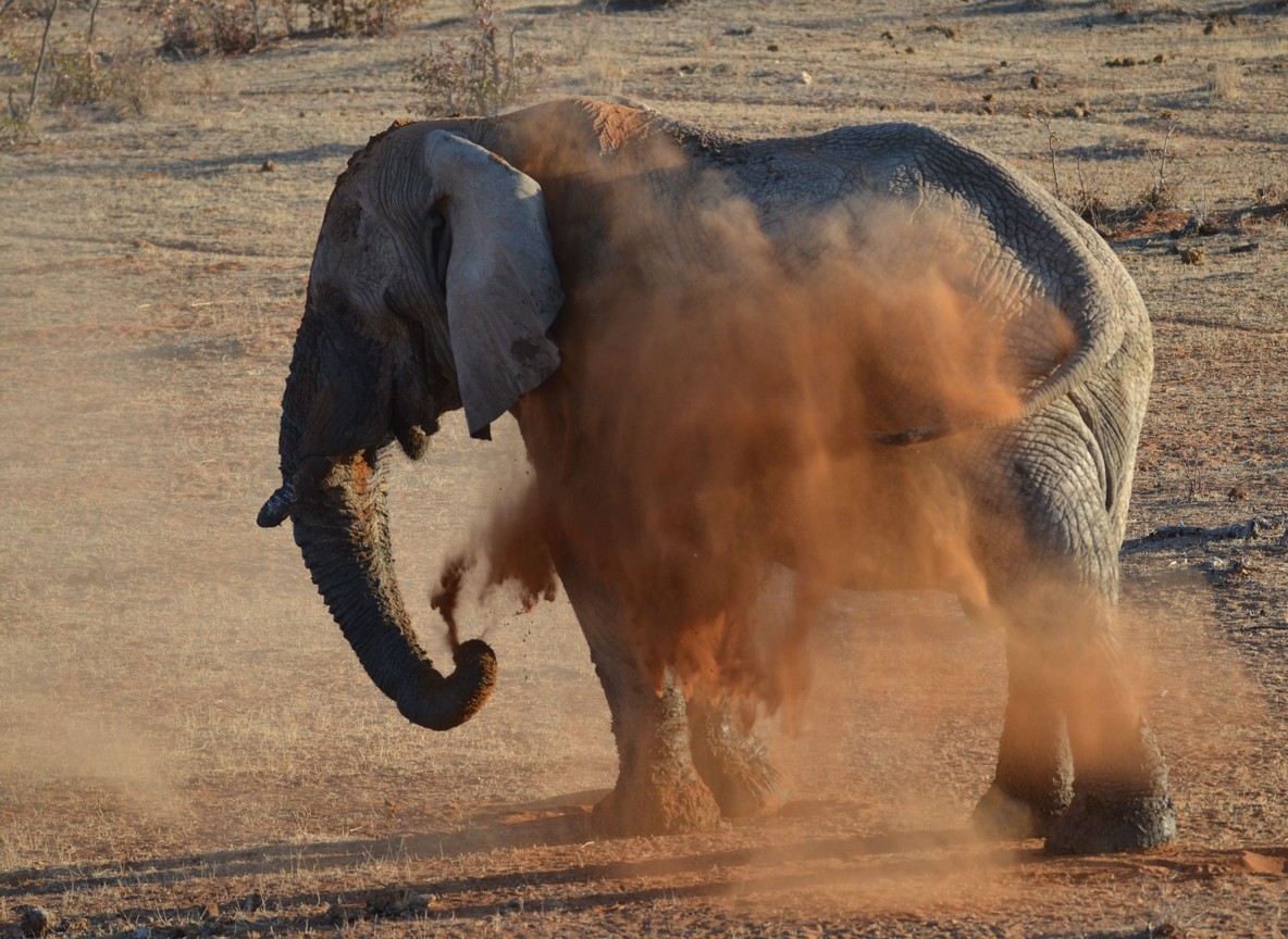
The long rains bring Tsavo’s most dramatic transformation. Dust turns to green scrub within weeks, and the parched nyika bush fills with new growth. Afternoon storms are usually short and heavy rather than constant drizzle, but they turn black-cotton soil sections of Tsavo West into a genuine mud hazard.
Wildlife spreads out across both parks as temporary water pools appear away from the main rivers, which can mean longer drives to find game. The payoff is the lowest camp rates of the year and a landscape most visitors never see in photos. April tends to be the wettest single month, so travelers with flexible dates often aim for early March or mid-May instead.
November to December: Short Rains and a Quiet Park
The short rains arrive in November and typically ease by mid-December. Storms tend to be brief afternoon downpours that clear fast, leaving mornings and evenings open for game drives. Tsavo turns green again, migratory birds arrive in large numbers, and newborn animals start appearing among resident herds.
This window draws the fewest visitors of the year outside the wettest patches of April. Camp rates drop toward green-season levels while roads generally stay more passable than during the long rains. December can get crowded briefly around the holidays at a handful of camps, so book those specific dates early if you want a festive-season trip.
Tsavo Month-by-Month at a Glance
| Season | Months | Daytime Temp | Rainfall Pattern | Game Viewing | Crowd Level |
|---|---|---|---|---|---|
| Long dry | June-October | 28-32°C | Under 20mm/month (indicative) | Best of the year, concentrated at water | Moderate, busiest of Tsavo’s year |
| Short dry | January-February | 30-34°C | 20-40mm/month (indicative) | Strong near rivers and dams | Light to moderate |
| Long rains | March-May | 26-30°C | Heaviest month April (indicative peak) | Scattered, harder to predict | Lowest of the year |
| Short rains | November-December | 27-31°C | Brief afternoon storms | Good, improving birdlife | Low, except holiday week |
Rainfall figures above are indicative long-term averages, not a forecast. Confirm current conditions with your camp or a licensed booking partner before travel.
Getting to Tsavo: Distances, Gates and Fees
Tsavo sits directly along the Nairobi-Mombasa corridor, which makes road access simpler than in many other Kenya parks. Mtito Andei Gate, the main entry point straddling both Tsavo East and Tsavo West, sits about 233 km from Nairobi on the A109 highway, roughly 3.5 to 4 hours by road. Voi Gate, the main entrance to southern Tsavo East, is about 330 km from Nairobi, closer to 5 hours by road.
Scheduled light-aircraft flights from Nairobi’s Wilson Airport reach Kilaguni Airstrip in Tsavo West or Voi Airstrip in Tsavo East in roughly 45 to 60 minutes. Non-resident park entry fees for Tsavo East and Tsavo West typically fall in the USD 30-52 per adult per day range, lower than Masai Mara or Amboseli rates. Treat this as an indicative range only and confirm current KWS fees through the eCitizen portal before you travel, since gates now process payment electronically rather than accepting cash.
Travelers coming from the coast have a third option worth knowing about. Diani Beach sits roughly 250-270 km from Tsavo East’s Sala Gate, which makes a two-park coast-and-safari combination possible in a single trip without a long detour inland. Many camps near Voi and Mtito Andei also arrange road transfers directly from Mombasa’s Moi International Airport, cutting out a Nairobi stopover entirely for coast-based itineraries.
| Detail | Tsavo East | Tsavo West |
|---|---|---|
| Park size | 13,747 km2 | 9,065 km2 |
| Main gate from Nairobi | Voi Gate, ~330 km | Mtito Andei Gate, ~233 km |
| Airstrip | Voi Airstrip | Kilaguni Airstrip |
| Signature water feature | Aruba Dam, Galana River, Lugard Falls | Mzima Springs |
| Non-resident daily fee (indicative) | USD 30-52/adult | USD 30-52/adult |
Explorer Notes
Skip the midday game drive in Tsavo between November and March. Heat drives animals into shade fast, and the light turns flat for photos by 11am. Push your second drive later into the afternoon instead, closer to 4pm, when animals move back toward water.
Mzima Springs in Tsavo West rewards an early stop. The underwater viewing chamber shows hippos and fish from below the surface, but tour groups from Mombasa-area lodges tend to arrive by mid-morning. Reaching it in the first hour after gate opening usually means having the chamber to yourself.
Ask your driver-guide about the Yatta Plateau before you go. This lava flow runs alongside Tsavo East’s western boundary for roughly 290 km, one of the longest such formations on earth, and most first-time visitors never learn it is there unless someone points it out.
Frequently Asked Questions
What is the single best month to visit Tsavo? September and October usually offer the strongest combination of dry roads, concentrated wildlife, and manageable heat, though July and August work nearly as well.
Is Tsavo worth visiting during the rainy season? Yes, if lower rates and quiet roads matter more than guaranteed dry-season sightings. Expect scattered wildlife and possible mud on Tsavo West’s black-cotton sections.
How hot does Tsavo get compared to the Masai Mara? Tsavo runs noticeably hotter year-round due to its lower elevation. Daytime highs regularly clear 30°C, several degrees above typical Mara temperatures.
Do Tsavo East and Tsavo West share the same seasons? Roughly yes, since both sit in the same semi-arid corridor. Tsavo West gets slightly more rainfall due to higher ground near the Chyulu Hills.
Can I visit Tsavo East and Tsavo West in one trip? Yes. Many itineraries combine both parks through Mtito Andei Gate, since the two sit adjacent to each other along the same highway corridor.
Once you have a season in mind, the next step is matching it to a route and camp near the right gate. Check Touring Insights’ Tour Packages page for current Tsavo itinerary options, or speak with a licensed booking partner about specific dates before locking in flights.
What to Read Next
- Tsavo East vs Tsavo West: Which Should You Choose?
- Tsavo National Park Kenya: The Complete Guide
- Amboseli vs Tsavo: Comparing Kenya’s Southern Safari Parks