Nairobi National Park has no fence on its southern side. Wildebeest, zebra, and giraffe walk straight out of the park onto private Maasai land, and they have done that for generations. When that land gets sold, fenced, and built on, the animals run out of room. Touring Insights looks at the plan that tried to stop that from happening: Kenya’s community land use master plan for the Kitengela-Isinya-Kipeto area, and what it still means for wildlife and herders today.
The plan is not new. Communities and the African Wildlife Foundation built it between 2004 and 2010. But it remains the country’s first formal, community-driven land use master plan, and it set the template every conservancy planning effort since has borrowed from.
What Is Kenya’s Community Land Use Master Plan?
The Kitengela-Isinya-Kipeto Land Use Master Plan covers roughly 60,000 hectares, or about 600 km2, of Maasai-owned land directly south of Nairobi National Park. Local landowners, organized through the Kajiado Pastoralists Forum, worked with the African Wildlife Foundation, Kenya’s Department of Physical Planning, and the Ministry of Lands to zone the area. The plan sets out where families can build, where they can farm, and where the land must stay open for cattle and wildlife.
Kenya’s Ministry of Lands formally adopted the plan in February 2010, and the Olkejuado County Council followed in July that year. Community members launched it publicly at Isinya on August 26, 2010, with more than 500 Maasai landowners in attendance. It runs as a 20-year framework, so it is now well into its second decade.
Why Nairobi National Park Depends on Land Outside Its Fence
Nairobi National Park covers just 117 km2, small enough to drive across in under an hour. Three sides of the park are fenced against the city, but the southern boundary stays open on purpose. That gap connects the park to the Athi-Kapiti plains, the open rangeland where migratory herds spend the dry season before moving back into the park.
This stretch of land is called the Kitengela wildlife dispersal area, and it works like an overflow valve for the park. Without it, Nairobi National Park cannot hold the animals that depend on it, since 117 km2 is not enough grazing for a full wildebeest and zebra population year round. Losing that corridor to fencing and subdivision would trap wildlife inside a park too small to sustain it.
Inside the Kitengela-Isinya-Kipeto Zonation Plan
The master plan divides the 60,000-hectare area into zones instead of leaving it to open-market land sales. Some zones stay reserved for grazing and wildlife movement, with subdivision limited or banned outright. Other zones near existing roads and towns get marked for housing and business growth, so development has somewhere planned to go instead of spreading across the whole corridor.
That zonation is the core idea behind every land use plan that followed it in Kenya, including newer masterplans covering parts of the Amboseli ecosystem. Planners set boundaries before landowners sell, rather than trying to undo subdivision after it happens.
Grazing Land vs Zoned Conservation Land
| Feature | Unplanned subdivision (pre-plan pattern) | Kitengela-Isinya-Kipeto zoned land |
|---|---|---|
| Land sale pattern | Open-market, plot by plot, no coordination | Zoned; some areas restricted from subdivision |
| Grazing corridor continuity | Broken up as fences and plots appear | Protected corridor zones kept open for cattle and wildlife |
| Wildlife dispersal from Nairobi National Park | Blocked as fencing spreads | Maintained through designated dispersal zones |
| Development | Unplanned, wherever land sells | Directed toward zones near roads and towns |
| Planning horizon | None; decided sale by sale | 20-year framework, adopted 2010 |
The Plan by the Numbers
| Detail | Figure |
|---|---|
| Plan area | Approx. 60,000 hectares (about 600 km2) |
| Nairobi National Park size | 117 km2, unfenced on the southern boundary |
| Plan adoption | February 2010 (Ministry of Lands), July 2010 (County Council) |
| Public launch | August 26, 2010, at Isinya, over 500 Maasai landowners present |
| Framework length | 20 years |
| Nairobi to Isinya | Approx. 50 km, roughly 1 hour by road on the Namanga road |
| Nairobi to Kitengela town | Approx. 30 km, roughly 45 minutes by road |
How the Plan Affects Maasai Herders Today
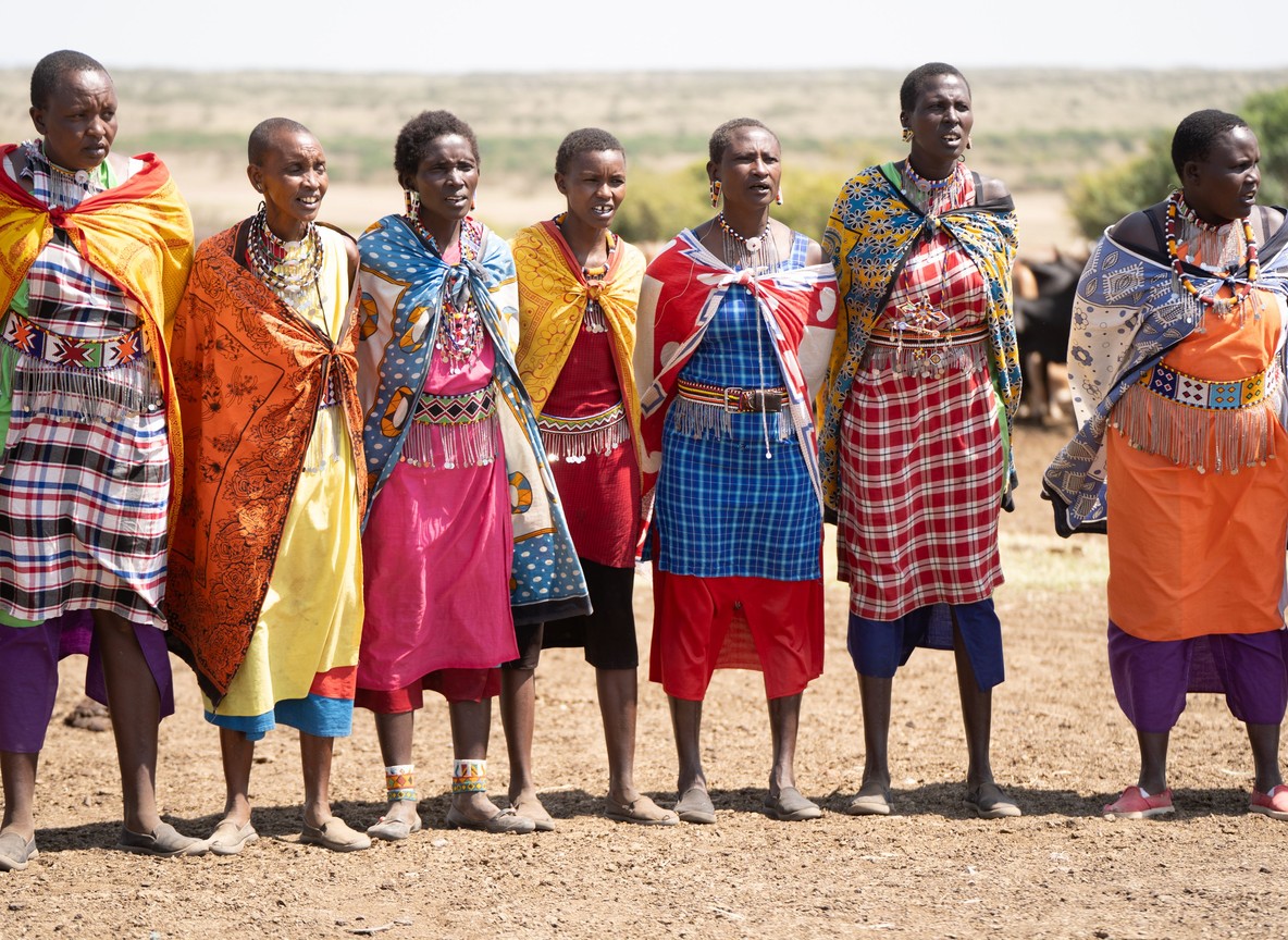
Cattle are still the backbone of Maasai livelihoods in Kajiado County. Community organizer Ogeli Makui, speaking when the plan launched, put it simply: without open rangeland for cattle, the Maasai way of life comes under threat. The zonation plan tries to protect that rangeland while still letting families benefit from land near growing towns.
Herders get clearer rules instead of guessing where the next fence will go up. A family can plan grazing routes with more confidence, since large blocks of the corridor stay legally set aside rather than sold off piece by piece. That certainty matters as much as any conservation outcome, because it lets households plan years ahead instead of reacting to a neighbor’s land sale.
AWF director Kathleen Fitzgerald, who backed the plan’s development, described it as one that balances the community’s long-term needs against the survival of the wildlife population. Neither side gets everything. Herders lose some flexibility on where they can build, and conservationists cannot protect every hectare. The plan works because both groups accepted that trade before subdivision made the choice for them.
Visiting the Kitengela Corridor on a Kenya Safari
Most visitors experience this corridor without knowing its name. Anyone driving from Nairobi toward Amboseli or the Tanzania border on the Namanga road passes straight through the Kitengela-Isinya-Kipeto zone. Wildlife sightings on that drive, giraffe near the roadside or zebra grazing beside cattle, are a direct result of this land staying open.
Nairobi National Park itself remains the easiest wildlife viewing stop near the city, roughly a 30-minute drive from downtown to the main gate on Langata Road. Combining a park visit with an understanding of the Kitengela corridor gives a fuller picture of why the park still holds wildlife despite sitting on a capital city’s doorstep.
Explorer Notes
Guides who grew up around Kitengela mention a few things worth knowing. First, the corridor is entirely private and community land, not park or reserve land, so there are no gates or entry fees to enter it, though you should stay on public roads unless invited onto private land. Second, look for the mix of cattle and wild grazers sharing the same open ground near Isinya and Kaputiei; it is one of the few places in Kenya where livestock and wildlife visibly share pasture rather than being fenced apart. Third, ask a Nairobi National Park ranger about “wet season dispersal,” the period when herds leave the park for Kitengela grass, since it explains why park sightings thin out at certain times of year. Finally, this same zoning model now informs newer land use plans in the Amboseli ecosystem, so a question about Kitengela is also a good way to understand conservation planning happening further south today.
What to Read Next
- Planning a stop at the source park itself? Read our Nairobi National Park guide.
- Curious how conservancies compare to national reserves for wildlife protection? See our community conservancy vs national reserve guide.
- Want to understand the herding culture behind this land use story? Check our Maasai cattle pastoralism guide.
FAQ
What is Kenya’s community land use master plan? It is the Kitengela-Isinya-Kipeto Land Use Master Plan, a 20-year zoning framework covering about 60,000 hectares of Maasai-owned land south of Nairobi National Park, built by local landowners with the African Wildlife Foundation and adopted in 2010.
Why does Nairobi National Park need land outside its own boundary? The park covers only 117 km2 and has no fence on its southern side. Migratory wildlife depends on the adjoining Kitengela plains for dry-season grazing, since the park alone cannot support the herds year round.
Does the plan stop Maasai families from selling or developing land? No. It zones the area so some land stays open for grazing and wildlife dispersal while other zones near roads and towns are set aside for housing and business growth, rather than leaving all decisions to individual land sales.
Can visitors see this wildlife corridor on safari? Yes. The Namanga road between Nairobi and Amboseli passes directly through the Kitengela-Isinya-Kipeto corridor, and wildlife sharing pasture with cattle is a common roadside sight for anyone making that drive.
Has this plan influenced other parts of Kenya? Yes. Its zonation approach has become a reference model for later community land use planning efforts, including newer integrated masterplans developing in the Amboseli ecosystem.
Understanding this plan changes how you see the open ground between Nairobi and Amboseli, since that unremarkable stretch of grazing land is the reason Nairobi National Park still has wildlife to see. If you are building an itinerary that starts in Nairobi and heads toward Amboseli or the Mara, visit our Tour Packages page or ask a partner operator how they route through community land like this along the way.