Most Kenya conservancies get quieter and drier as the dry season wears on. Their wildlife scatters wherever the last puddle survives. Ol Pejeta is trying to break that pattern. Over the past several years the conservancy has built a 20-year water master plan. It lays new pipeline, drills solar boreholes, and restores dams so wildlife has reliable water even when the rains fail. For a visitor, that infrastructure raises a planning question. When does water management actually improve your odds of a great game drive? Touring Insights put this guide together to walk through the dry season calendar and the water plan’s mechanics. It also covers the real numbers you need to plan the trip.
When Is the Best Time to Visit Ol Pejeta Conservancy?
The dry months from late June through October are the strongest window for game viewing at Ol Pejeta. Grass thins out across the plateau and natural pans dry up. Animals then concentrate around the conservancy’s managed water points. That makes sightings more predictable along the drive routes near dams and troughs. A shorter dry spell in January and February offers a similar effect with fewer vehicles on the tracks. The long rains from March to May and the short rains in November and December green up the landscape fast. That is beautiful for photography, but it scatters wildlife across a wider area. Game drives then take longer to produce sightings.
If your travel dates are fixed rather than flexible, the shoulder weeks matter more than the calendar headline. Early June and early November often still carry dry-season habits from the previous stretch. Animals have not yet spread out, even though the season label has technically changed. Local guides track this better than any generic seasonal chart. It is worth asking your camp for a read on current grass and water conditions. Do this a week or two before you travel.
Why Ol Pejeta’s Water Strategy Changes the Dry-Season Equation
Most East African parks depend almost entirely on rainfall and a handful of rivers. A poor rainy season then means real water stress for wildlife by August or September. Ol Pejeta has spent years trying to decouple its dry-season game viewing from that risk. It diversifies supply across boreholes, dams, and pipeline instead of relying on the Ngobit River alone. That means the conservancy can keep troughs full even when nearby rivers run low. For a visitor, this makes wildlife concentration around water points more consistent from one dry season to the next. It is not a gamble on how the rains behaved that year.
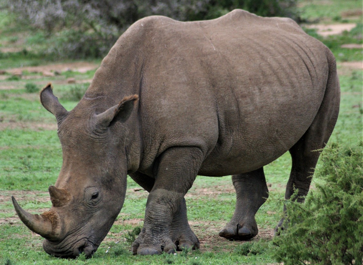
The same reasoning applies to the rhino population Ol Pejeta is best known for protecting. Rhinos need to drink daily and rarely wander far from a reliable source in dry months. A conservancy with dependable water is also a conservancy where rhino tracking stays productive, even in a below-average rainfall year. That link between water security and predictable sightings is the real reason the water plan matters to a visiting traveler. It matters beyond Ol Pejeta’s own conservation targets too.
Inside the Water Master Plan: Dams, Boreholes, and the Ngobit River
Ol Pejeta’s water strategy is a 20-year plan first developed in 2019. It is built around three sources working together instead of one. The Ngobit River remains the historical backbone of supply. It is now backed by solar-powered boreholes tapping groundwater, plus a mix of restored and newly built dams. These capture rainfall during the wet months and release it slowly through the dry ones.
By the end of 2026, the conservancy aims to replace roughly 60 km of pipeline. Much of it is buried around three feet underground specifically to stop elephants from damaging the lines. That is a real engineering constraint unique to wildlife infrastructure. Smart meters now monitor water levels and flow in real time. They catch leaks and blockages before a trough runs dry. The conservancy has pointed to February 2026 as a season with no water shortage at all. That month is usually a stress period for water. It credits dam storage built up during the prior wet season.
Month-by-Month: What to Expect at the Water Points
| Period | Months | Rainfall Pattern | Water-Point Game Viewing |
|---|---|---|---|
| Short dry season | January-February | Minimal rain | Strong; grass still short from prior dry spell |
| Long rains | March-May | Heaviest rainfall of the year | Weaker; wildlife disperses across fresh grazing |
| Cool dry season | June-October | Little to no rain | Peak; troughs and dams draw consistent wildlife traffic |
| Short rains | November-December | Moderate, often afternoon showers | Mixed; early Nov still good, late Dec greens up fast |
Where to See Wildlife Gather Around Water
The clearest water-point viewing tends to happen along the dam circuits in the conservancy’s central and southern sections. Rhino, elephant, and buffalo move through these areas on a predictable rhythm during the dry months. Ol Pejeta is East Africa’s largest black rhino sanctuary by its own conservancy figures. Both black and southern white rhino sightings cluster more tightly around water during the June to October stretch. The Sweetwaters Chimpanzee Sanctuary, Kenya’s only home for chimpanzees, sits inside the conservancy. It runs on a managed enclosure rather than natural water points. Treat it as a worthwhile add-on rather than part of the dry-season wildlife-and-water story.
How Ol Pejeta Compares to Other Laikipia Conservancies
Ol Pejeta sits alongside neighbors like Lewa, Borana, and Loisaba on the wider Laikipia Plateau. All of them share the same dry-season logic: water security drives sighting quality more than any other single factor. Ol Pejeta’s edge is scale and infrastructure investment. At roughly 90,000 acres, it is large enough to support both black and southern white rhino populations plus predators. Its water plan is also one of the more heavily documented in the region. Lewa and Borana run smaller, more intimate operations with their own conservation programs. Loisaba leans toward a wilder, less developed feel. None of that makes one better than another. It just means a traveler should ask each conservancy directly about current water and dam conditions for their travel dates. Even strong infrastructure cannot fully offset an unusually poor rainy season.
Getting to Ol Pejeta: Distances, Drive Times, and Airstrips
| Route | Distance | Typical Time |
|---|---|---|
| Nairobi to Ol Pejeta by road (via Nanyuki) | About 200 km | 4 to 4.5 hours |
| Nairobi Wilson Airport to Nanyuki by air | N/A | About 45 minutes |
| Nanyuki town to Ol Pejeta main gate | About 20 km | 30 to 40 minutes |
Most visitors drive up via Nyeri and Nanyuki. Others fly into Nanyuki Airport and transfer by road or take a short charter hop. The conservancy also operates its own airstrip for camp transfers.
Fees and Practical Planning Facts
Ol Pejeta covers roughly 90,000 acres, about 364 km2. It sits on the Laikipia Plateau between the foothills of Mount Kenya and the Aberdare Range. Non-resident entry runs in the indicative range of $90 to $100 per person per day. This is not an official figure and rates change. Confirm the current price directly with Ol Pejeta Conservancy before you book. Most camps and lodges quote all-inclusive rates that bundle the conservancy fee into the nightly price. Ask what is and is not included when comparing options.
Explorer Notes
Ask your guide to route toward the dam circuits in the mid-morning during dry season. Animals that drank at dawn are often still lingering nearby, rather than already moved off into thicker bush. If you are visiting in the shoulder months of January or November, pack for both dust and sudden rain. The transition weeks can swing hard in either direction within the same day. Binoculars earn their keep here more than in denser bush parks like the Mara. Ol Pejeta’s open plateau terrain lets you scan long distances toward a trough or dam. That helps you decide which track to follow.
What to Read Next
- Curious how Ol Pejeta compares to its Laikipia neighbors? Read our Laikipia conservancies guide.
- Want the wider picture on rhino conservation in Kenya? See our Kenya rhino sanctuaries guide.
- Trying to time a trip around rainfall elsewhere too? Check our dry season vs wet season wildlife guide.
FAQ
What is the best month to visit Ol Pejeta Conservancy? July through September tends to deliver the most consistent water-point sightings. The dry season is well underway and the conservancy’s managed water sources stay full.
Does Ol Pejeta get too dry to visit in the dry season? No. The conservancy’s water master plan, including boreholes, dams, and pipeline, is built to keep troughs full through the driest months. That is part of what makes dry-season viewing reliable here.
How far is Ol Pejeta from Nairobi? About 200 km by road, roughly a 4 to 4.5 hour drive via Nanyuki. Or fly in about 45 minutes to Nanyuki Airport, followed by a short road transfer.
Can I see rhinos at Ol Pejeta year-round? Yes, rhino sightings happen in every season. Dry-season months tend to concentrate them more predictably around water points, which can mean shorter drive times between sightings.
Is Ol Pejeta good for a first-time safari or a second trip? Both, but it particularly rewards travelers who have already done a Mara or Amboseli trip. They will appreciate the different landscape, rhino density, and the added chimpanzee sanctuary.
Ready to build the rest of the itinerary around a Laikipia stop? Visit the Tour Packages page to compare Kenya safari routes that include Ol Pejeta alongside the Mara or Amboseli.